SafeLink | Water, Water, Everywhere!
Awards & Nominations
SafeLink has received the following awards and nominations. Way to go!
The Challenge | Water, Water, Everywhere!
SafeLink
The SafeLink mission is to help prevent the significant human cost of flood disasters by providing people in flood emergencies with access to the immense amount of data collected by spaceborne platforms, in an accessible and useful format.

INTRODUCTION
Floods are Australia's most expensive form of natural disaster. However, the cost of floods at home pales in comparison to the global cost in human lives.
The SafeLink mission is to help prevent the significant human cost of flood disasters by providing people in flood emergencies with access to the immense amount of data collected by spaceborne platforms, in an accessible and useful format.
Data is aggregated from the Global Flood Monitoring System (GFMS) (with plans to also include data from the NRT Global MODIS Flood mapping system), and combined with local hydrology, topology and historical flood study data sets. This aggregated data is used to provide the core platform - a live, geospatial global flood tracking and prediction service.
However, the platform alone is not enough. After speaking with Red Cross volunteers, we discovered that the way most people on the ground get information about floods which are a risk to them is via a simple ‘flood alert’ text message. This text message leaves a lot of questions in users minds - “How at risk am I?”, “What’s my safest way out of here?” and “How can I avoid the flood waters?”.
These are the core immediate problems SafeLink seeks to help with. We plan to partner with telecommunications companies and emergency services to augment the existing emergency text message with URL links to our platform - one link for a user to monitor the local situation, and another to find the safest route out.
Routes provided consider real time road accessibility data based on the extent of flood waters, as well as traffic congestion. The advice is determined based on the most up to date flood information from the aggregated data platform, along with extra information from local emergency services, to provide users with the safest way out of danger. The key goals of SafeLink are to ensure:
- that key data is accessible to emergency authorities, as well as citizen users
- emergency authorities can provide citizens with warnings targeted to their location
- citizens can evacuate in the safest manner when their position is at risk
- citizens can begin to prepare for evacuation when it is clear that their position may become unsafe
- citizens can see the safest escape route to nearby landmarks, emergency meeting points, or their own chosen destination
HOW IT WORKS
SafeLink takes data from two key sources: the GFMS and local knowledge.
GFMS
The Global Flood Monitoring System (GFMS) provides real time updates (3 hour frequency) of current flood levels across the globe. This is done by combining TRMM Multi-satellite Precipitation Analysis (TMPA) precipitation information with a hydrological model. The historical flood level information in the model was derived for grid locations using surface water storage statistics. See here for more information.
Local knowledge
The GFMS is an excellent global resource. However, for the most accurate and reliable evacuation advice, this should at least be validated (and preferably supplemented) by local data gathered by emergency responders. Emergency authorities can place virtual roadblocks to let citizens know that certain evacuation routes are not suitable. When this is done, SafeLink provides citizens with alternative evacuation routes.
Authorities can also define more granular evacuation boundaries. Current warning systems cover a wide range of citizens based off cellular tower data. SafeLink allows authorities to draw boundaries via a GIS interface, resulting in more people evacuating when they should, and less when they don't need to. The net result is that only the people who need to evacuate are on the road, reducing congestion.
In addition to evacuation guidance, general flood safety and links to other resources can be provided to citizens based on the current warning level in their area.
TECHNOLOGY
The technology required to build SafeLink is already quite established. The development process will involve expanding on what we’ve done to build the most robust and reliable platform, by selecting the right combination of these tools, and combining them into a single piece of globally accessible software.
Mapping
Various map APIs are available for creating the user GIS interfaces including Mapbox or Google Maps.
Databases
PostgreSQL is well suited the maintenance of global flood level data. Information can be readily drawn from that into a map API.
Infrastructure
Amazon Web Services or Google Cloud are both excellent resources for serving the software and maintaining databases.
Vehicle routing
Our team is very familiar with a range of python libraries for this purpose. NetworkX is a great resource for simple path finding problems, with Gurobi being another tool that could be useful when more complex routing decisions are to be made.
Interface
The user interface for both the emergency authority and the citizen is a web browser. In the future, it may make sense to provide authorities with a more powerful interface for responders to take into the field.
Messaging
While SafeLink is designed to be sent within a message from authorities, in case where this is not available, various tools exist that SafeLink itself could use to send alerts with the link embedded.
THE TEAM, THE DREAM
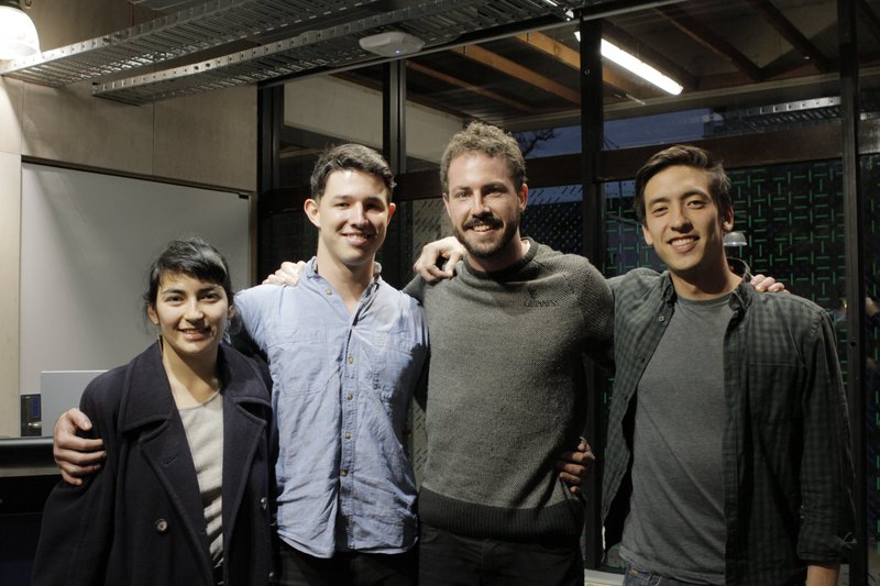
The SafeLink team currently consists of four humanitarian minded entrepreneurs from Melbourne, Australia. Between us, we have a diverse set of skills - data science, GIS platforms, UX, product design, mathematics and government and telecommunication consulting. We’re immensely excited to continue the technical and commercial validation of SafeLink, and hope that through SpaceApps, we’re able to take it to the world.
SpaceApps is a NASA incubator innovation program.