


Napearte | Where's the Water?
Awards & Nominations
Napearte has received the following awards and nominations. Way to go!
The Challenge | Where's the Water?
Napearte
Our app consists of an open, easy to access database about the distribution of water both above and below ground level.
Our vision is tocollect all data regarding water (most specifically phreatic zones) in both urban and suburbanareas. This allows for a better understanding of our soil, helping localauthorities manage our landmore efficiently.
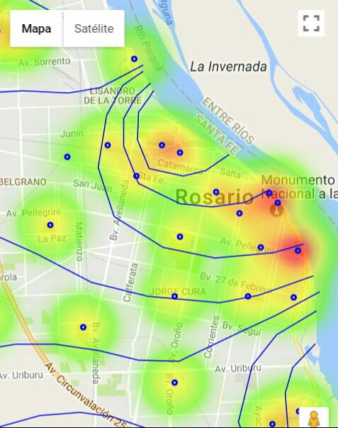
Our app collects phreatic depth measurements from various sources (including our own sensors), combines them with weather and historical data and processes them using functional data analysis in order to create a gradient map showing the distribution and depth of underground water.
By making this data publicly available, we will help both public and private sectors improve spatial planning and make a more efficient use of natural resources.
In order to address this issue, a webapplication was developed using Bootstrap as our front-end framework andthe Google Maps Javascript API to visualize our data in a friendly and readableway. A functional data analysis algorithm (written in Python, check full project document) runs on the server side and generates the gradient map that is then shown in the client side.
Our prototype was built using dataprovided by qualified professionals.
Full project document: https://www.dropbox.com/s/t2fex5sp001weij/Napearte...
Use Napearte: www.napearte.com
Slides: http://prezi.com/745ymfmmxepe/?utm_campaign=share&...

SpaceApps is a NASA incubator innovation program.