Fire Warden | And YOU can Help Fight Fires!
Awards & Nominations
Fire Warden has received the following awards and nominations. Way to go!
The Challenge | And YOU can Help Fight Fires!
Fire Warden
We look to apply crowdsourcing of new fires and predictive modelling to support emergency worldwide.

“Fires affecting developing countries impact the livelihoods of people much more than those in wealthy and `insured’ countries,” - GFMC.
Fire Warden is a web app that combines crowdsourced data, predictive modelling and navigational services looking to assist communities and emergency services in high risk busk/wildfire regions around the world.
Crowdsourced Data Collection
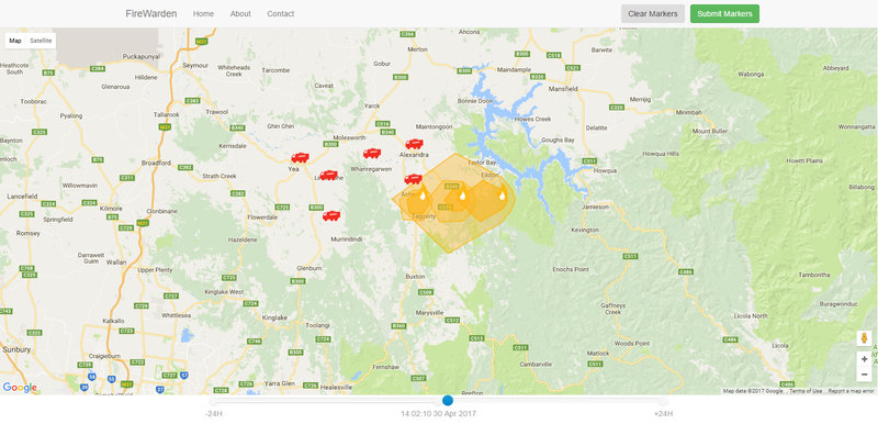
Users log fires by clicking on the map, noting it's location and adding any additional features worth communication to people in the area, as well as emergency services.
Predictive Modelling
Bush and wildfires spread based off of 4 contributing factors; temperature, wind direction and speed, humidity and elevation. Using available data from the National Oceanic and Atmospheric Administration and Google Maps we have been able to predict the spread of a reported fire over time.
Safe Navigation
A time slider shows the predicted growth and path of the fire. This allows Fire Warden to direct individuals and emergency services to or away from the fire, using the safest path. It also identifies potential at-risk areas in the path of the reported location.
Fire Warden has application for countries with established-centralised fire and rescue services as well as those communities which do not have access to those facilities; improving the delivery of emergency assistance to all locations that require it.
https://github.com/siod/firewarden
Music by www.pacdv.com/sounds/
SpaceApps is a NASA incubator innovation program.