firefinder.eu | And YOU can Help Fight Fires!
Awards & Nominations
firefinder.eu has received the following awards and nominations. Way to go!
The Challenge | And YOU can Help Fight Fires!
Firefinder.eu
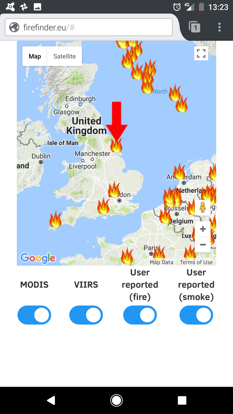
Overlaying data on fires and bright-spots from multiple sources on to a navigable map

firefinder.eu overlays data from two NASA satellites that observe bright spots, along with user contributed data to map possible fires on Google maps.
User data is captured directly from the web app and the satellite data sets imported separately. The application can also be extended to watch twitter hashtags and potentially other social data.
Layers of data can be turned on and off to allow users to look at data more reliable and relevant to them.
We made use of the MODIS and VIIRS data for Europe, the Google Maps API and code samples from StackOverflow and W3Schools. Some parts of the BootStrap framwork have also been used.
The application is written in HTML, JavaScript (including jQuery), PHP and SQL and uses a MySQL database.
The tables are set to be innoDB to allow faster response when writing the data. The data for the overlays should be updated on a schedule to reduce load on the DB in a real world use of the system.
Features we would have liked to add, but didn't have time:
- Smoke based on prevailing wind from the satellite data
- Confidence ranking against data points, including those from users
- Navigation tools to quickly plot routes away from the fire and smoke
SpaceApps is a NASA incubator innovation program.